Software tools
To facilitate airborne research measurements, a number of EUFAR’s activities are dedicated to developing and maintaining a range of toolboxes that serve to assist operators and researchers with the handling of data. From in-situ or remote sensing data collection to data processing, analysis and archiving, these toolboxes are made freely accessible on or via the EUFAR website and are documented in user manuals.
The Standards and Protocols (S&P) activity aims to efficiently integrate data in the EUFAR database and ensure its interoperability with other standards by developing and updating open-source data processing toolboxes. The activity also keeps track of existing open-source toolboxes, which would be relevant for operators and users within EUFAR. For example, the S&P team proposes a set of tools dedicated to the processing of in-situ data (EGADS) and the creation of INSPIRE compliant metadata for in-situ and hyperspectral data (EMC and ASMM). Through the Database activity, data from EUFAR transnational access campaigns are stored and made widely accessible online through a single gateway, with a search tool to facilitate locating specific data (EFF). In addition, data are stored in community compliant data formats with well-documented supporting metadata. Toolboxes are also developed as part of EUFAR’s Education & Training activity with the aim to familiarise and assist early researchers participating in training courses with the different aspects of airborne research for the environment. EUFAR’s Joint Research Activities are dedicated to developing methodologies and tools for the integrated use of airborne hyperspectral imaging and airborne laser scanning data (HYLIGHT and HYSOMA).
Software tools
Tools found: 37
Metadata
- ASMM
- Airborne Science Mission Metadata
- Publisher: EUFAR (Matt Freer, Olivier Henry)
- Producer: EUFAR
- Status: Ready to use
This project intends to develop a tool for creating, modifying and viewing Airborne Science Mission Metadata (ASMM) XML files.
- ...
- EMC
- EUFAR Metadata Creator
- Publisher: EUFAR (Olivier Henry)
- Producer: EUFAR
- Status: Ready to use
The EUFAR Metadata Creator intends to make a database compatible with INSPIRE initiative by creating a standard set of metadata.
- ...
Data Processing
- EGADS - CORE
- EUFAR General Airborne Data-processing Software - CORE
- Publisher: EUFAR (Matt Freer, Olivier Henry)
- Producer: EUFAR
- Status: Ready to use
The EUFAR General Airborne Data-processing Software is a toolbox for processing airborne atmospheric data.
- ...
- EGADS - GUI
- EUFAR General Airborne Data-processing Software - GUI
- Publisher: EUFAR (Olivier Henry)
- Producer: EUFAR
- Status: Under development
The EGADS GUI is a graphical interface to interact easily with EGADS and other modules without the need of a Python script.
- ...
- HYLIGHT
- HYLIGHT
- Publisher: EUFAR (Joint Research Activity - HYLIGHT development team)
- Producer: EUFAR
- Status: Ready to use
The main objective of the HYLIGHT joint research activity is to improve hyperspectral imaging processing using airborne laser scanning
- ...
- HYSOMA
- HYperspectral SOil MApper
- Publisher: GFZ German Research Center for Geosciences
- Producer: EUFAR
- Status: Ready to use
The HYSOMA is a software for soil mapping applications of hyperspectral imagery developed by GFZ German Research Center for Geosciences.
- ...
- PML IOP Model
- PML Inherent Optical Property Model
- Publisher: Plymouth Marine Laboratory - Remote Sensing Group
- Producer: EUFAR
- Status: Ready to use
The IOP model was provided in EGADS toolbox and is now available as a standalone.
- ...

- ARTMO
- Automated Radiative Transfer Models Operator
- Publisher: Image Processing Laboratory of the University of Valencia
- Producer: Other
- Status: Ready to use
The ARTMO GUI provides essential tools for running and inverting a suite of plant RTMs.
- ...
- ENMAP-BOX
- ENMAP-BOX
- Publisher: Humboldt-Universität zu Berlin
- Producer: Other
- Status: Ready to use
The EnMAP Box is a free software designed to process hyperspectral remote sensing data and EnMAP sensor data.
- ...
- GMT
- The Generic Mapping Tools
- Publisher: Paul Wessel, Walter H. F. Smith, Remko Scharroo, Joaquim Luis and Florian Wobbe
- Producer: Other
- Status: Ready to use
GMT is an open source collection of about 80 command-line tools for manipulating geographic and Cartesian data sets.
- ...
- HiiHAT
- HiiHAT
- Publisher: Jet Propulsion Laboratory (NASA)
- Producer: Other
- Status: Ready to use
HiiHAT is an intelligent assistant to help analysts efficiently browse, summarize, and search hyperspectral images.
- ...
- HSDAR
- Hyperspectral data analysis in R
- Publisher: HSDAR development team
- Producer: Other
- Status: Ready to use
The HSDAR package contains classes and functions to manage, analyse and simulate hyperspectral data.
- ...
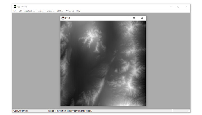
- HYPERCUBE
- HYPERCUBE
- Publisher: ERDC’s Geospatial Research Laboratory
- Producer: Other
- Status: Ready to use
HyperCube is a program created by ERDC’s Geospatial Research Laboratory (GRL) that analyzes and displays multi- and hyper-spectral imagery.
- ...
- HyperMixTool
- HyperMixTool
- Publisher: Research Group "Hyperspectral Computing" (HyperComp), University of Extremadura
- Producer: Other
- Status: Ready to use
HyperMix is a free open source tool, including several popular algorithms, dedicated to remote sensed hyperspectral image unmixing.
- ...
- HyperSpy
- HyperSpy
- Publisher: HyperSpy development team
- Producer: Other
- Status: Ready to use
HyperSpy is an open source Python library which provides tools to facilitate the interactive data analysis of multi-dimensional datasets.
- ...
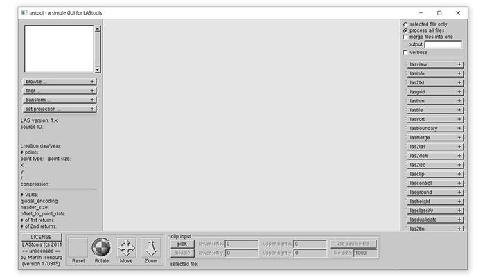
- LAStools
- LAStools
- Publisher: Rapidlasso GmbH
- Producer: Other
- Status: Ready to use
LASTools is a collection of highly efficient, batch-scriptable, multicore command line tools to classify, tile, convert, filter, raster ...
- ...
- MultiSpec
- MultiSpec
- Publisher: Purdue Research Foundation (David Landgrebe and Larry Biehl, Purdue University and School of Electrical and Computer Engineering)
- Producer: Other
- Status: Ready to use
MultiSpec is a processing system for interactively analyzing Earth observational multispectral image data, such as that produced by Landsat.
- ...
- NPLUnc_10x
- NPLUnc_10x
- Publisher: NPL
- Producer: Other
- Status: Ready to use
NPLUnc_101 and NPLUnc_102 are software to promote and support the use of the Guide to the expression of uncertainty in measurement (GUM).
- ...
- OPALS
- Orientation and Processing of Airborne Laser Scanning
- Publisher: University of Technology of Vienna
- Producer: Other
- Status: Ready to use
The aim of OPALS is to provide a complete processing chain for processing airborne laser scanning data (waveform decomposition, ...
- ...
- PRISM
- Processing Routines in IDL for Spectroscopic Measurements
- Publisher: U.S. Geological Survey
- Producer: Other
- Status: Ready to use
The Processing Routines in IDL for Spectroscopic Measurements (PRISM) provides a framework to conduct spectroscopic analysis.
- ...
- PROJ.4
- PROJ.4
- Publisher: Frank Warmerdam
- Producer: Other
- Status: Ready to use
PROJ.4 is a standard Unix filter function which converts geographic longitude and latitude coordinates into cartesian coordinates.
- ...
- PulseWaves
- PulseWaves
- Publisher: Martin Isenburg
- Producer: Other
- Status: Ready to use
PulseWaves is an open, vendor-neutral, stand-alone, LAS-compatible effort for exchange format concerning geo-referenced full wave LiDAR.
- ...
- Spectronon
- Spectronon
- Publisher: Resonon
- Producer: Other
- Status: Ready to use
Spectronon is a data acquisition and analysis software package, it provides hyperspectral data visualization and analysis capabilities.
- ...
- SPy
- Spectral Python
- Publisher: Thomas Boggs
- Producer: Other
- Status: Ready to use
SPy is a pure Python module for reading, displaying, processing, manipulating, and classifying hyperspectral image data.
- ...
Data Explorer
- EFF
- EUFAR Flight Finder
- Publisher: Centre for Environmental Data Analysis
- Producer: Other
- Status: Ready to use
The EUFAR Flight Finder tool is a geospatial-temporal search interface to locate EUFAR data within the EUFAR data archive at CEDA.
- ...
Educational Material

- ARTMO
- ARTMO
- Publisher: VERRELST Jochem
- Producer: Other
- Status: Ready to use
Hands-on lesson and data for ARTMO
- ...
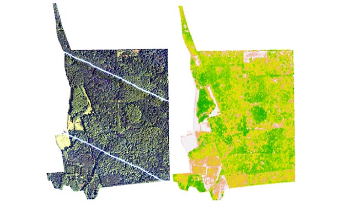
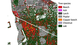
- Data Fusion
- RS4forestEBV Data fusion training course
- Publisher: EUFAR (Ils Reusen)
- Producer: Other
- Status: Ready to use
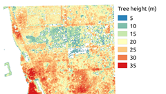
Hands-on lesson and data on data fusion of airborne hyperspectral images and LiDAR data for vegetation species classification
- ...
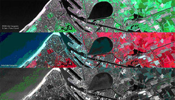
- Hyperspectral remote sensing
- Hyperspectral remote sensing, data processing and analysis training course
- Publisher: Ils Reusen (VITO) & NCEO, BAS, PML
- Producer: Other
- Status: Ready to use
Videos, hands-on lessons and data for airborne hyperspectral remote sensing
- ...
- LiDAR
- RS4forestEBV training course - LiDAR
- Publisher: Hooman Latifi
- Producer: Other
- Status: Ready to use
Hands-on lesson, data and scripts for airborne LiDAR data processing in forestry
- ...
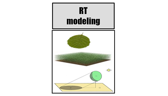
- RT modeling
- RS4forestEBV RT modeling training course
- Publisher: Clement Atzberger
- Producer: Other
- Status: Ready to use
Hands-on lesson, data and code on INFORM (Atzberger, 2000; Schlerf & Atzberger, 2006), a SAIL-like canopy model modified to simulate forest
- ...

- Turbulence and clouds
- TETRAD
- Publisher: Marie Lothon
- Producer: Other
- Status: Ready to use
Hands-on lessons for airborne measurements in atmospheric science: focus on turbulence and clouds (TETRAD).
- ...
- Vegetation classification
- SWAMP
- Publisher: EUFAR (Ils Reusen)
- Producer: Other
- Status: Ready to use
Hands-on lesson and data for vegetation studies with pktools (SWAMP).
- ...
Geographic Information System
- ArcGIS Earth
- ArcGIS Earth
- Publisher: ESRI
- Producer: Other
- Status: Ready to use
Explore any part of the world with ArcGIS Earth, work with a variety of data formats, display data, sketch placemarks, measure distances.
- ...
- GRASS GIS
- Geographic Resources Analysis Support System GIS
- Publisher: GRASS development team
- Producer: Other
- Status: Ready to use
GRASS GIS is a free and open GIS software suite used for geospatial data management, analysis, image processing, graphics, spatial modeling.
- ...
- gvSIG
- gvSIG
- Publisher: Asociacíon gvSIG
- Producer: Other
- Status: Ready to use
gvSIG, the Open Source Geographic Information System, a powerful, user-friendly, interoperable GIS used by thousands of users worldwide.
- ...
- QGIS
- Quantum GIS
- Publisher: Open Source Geospatial Foundation
- Producer: Other
- Status: Ready to use
QGIS is a user friendly Open Source Geographic Information System (GIS) and developed by the Open Source Geospatial Foundation (OSGeo).
- ...
- SAGA GIS
- System for Automated Geoscientific Analyses GIS
- Publisher: SAGA Development Team (Institute of Geography, University of Hamburg)
- Producer: Other
- Status: Ready to use
SAGA is a free open source GIS software and has been designed for an easy and effective implementation of spatial algorithms.
- ...